Permafrost monitoring up to 50m depth
Text by Fieke Rader // Norwegian Polar Institute
In Kongsfjorden and on the Brøggerpeninsula, the science not only quantifies our visible environment – the glaciers we see shrinking, the daily changes in the weather, the structure of the snow, the return of the birds or the auroras in the sky; it also reveals hidden parts of our natural environment, invisible to our direct sight.
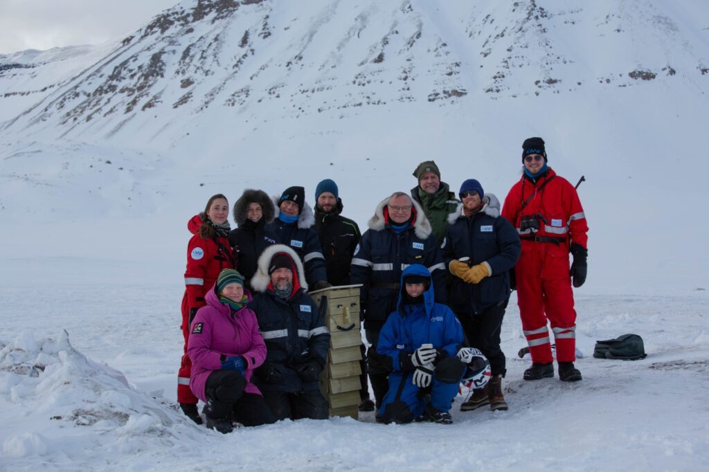
Since March 2026, researchers have gained a new insight into the deeper layers of the permafrost. A team of eleven scientists and technicians from the Alfred-Wegener-Institute drilled and cored a new borehole at the Bayelva permafrost site at Leirhaugen. While the already existing borehole called Mr. Moustache allowed permafrost measurements down to 9m depth, his new partner – Ms. Moustache – reaches a depth of 50m. In the increasingly warm climate this expansion is essential to understand future permafrost thaw and its associated impacts.
Box 1: AWI Bayelva Permafrost site
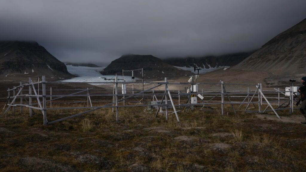
The Bayelva permafrost site at Leirhaugen was established in 1998, and started with measuring soil parameters (soil temperature and moisture profiles), snow depth and atmospheric parameters such as temperature, net radiation, precipitation.
Over the years, the permafrost site has undergone several upgrades – including the installation of a webcam, a permafrost sensor to measure the deeper layers in the soil up to 9m depth, a snow-water-equivalent sensor, snow-temperature and blowing snow sensors, and a microphone for ecological sounding.
The permafrost group and site is led by Julia Boike, who works closely together with other scientists studying permafrost around Ny-Ålesund, including the University of Oslo and CNR.
A changing climate, a changing soil
Since the beginning of the measurements in 1998, several clear trends have been observed. Besides the increased mean annual air temperature of +2.4 *C, rainfall has increased whereas snowfall has decreased. The number of snow-covered days has declined by 37 days, meaning that snow-free conditions now last more than a month longer. Whereas the active layer (the soil that freezes and thaws annually) has become warmer and has thickened, the permafrost at deeper layers stayed relatively stable (a change from -3.5 to -3.3 °C).
Coring and tasting
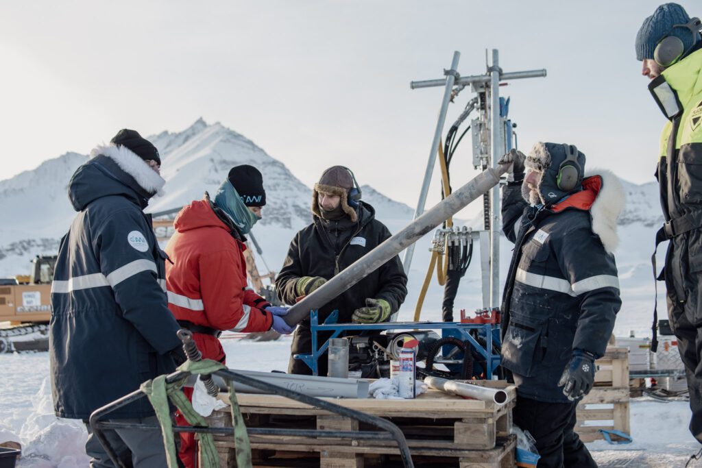
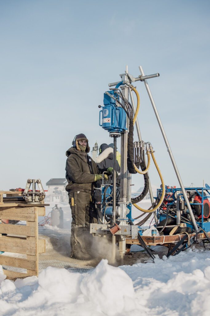
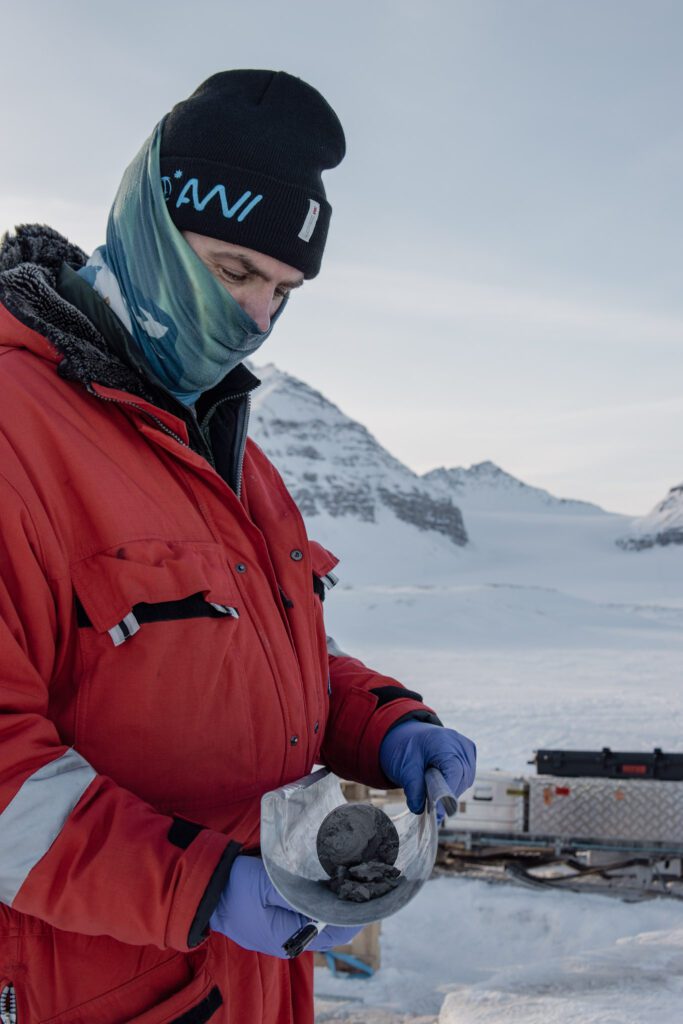
The campaign was not just about drilling a hole in the ground. The first 6.2m were cored, and the retrieved cores were roughly analyzed on site (including visual, taste and structure checks), before shipment back to Potsdam for further analysis. Both the drilling and the coring required many people and plenty of logistics – a generator from Kings Bay, a corer/driller from Kolibri AS, and many experts to help operate the equipment and to retrieve and analyze the cores. Some experts with good technical knowledge, some with strong arms, some with good eyes to spot potential polar bears, and some with fine taste buds on the tongue – the soil was put in the mouth to determine its type and grain size as real geologists do.
Box 2: The soil on Leirhaugen
The coring provided an insight in the soil properties of Leirhaugen. The first two meters consisted of sandy clay loam, and bedrock was already encountered on this depth. However, this was not stable bedrock – the weathered sandstone was full of ice in the fractures and pores – and the rock is therefore expected to deform when the ice melts. Permafrost, ground that has been below 0°C over at least two years, started at 1.9m depth.
The coring needed to happen slowly and carefully, and it took three days to reach 6 meter. The drilling happened much faster. In three more days, the borehole was drilled up to 50m depth. At 15m depth, there was a thin coal layer, followed by a layer of water. At 17m a clear coal layer again. The deeper depths mainly were bedrock (sandstone).
After the coring and the drilling, the borehole was to be finalized by installing two pipes and an ERT sensor cable and temperature sensors were installed. ERT, standing for Electrical Resistivity Tomography, is a technique used for imaging sub-surface structures and water forms (ice and liquid water).
In the end of March, Ms Moustache was officially inaugurated, and Ny-Ålesund was invited to join. The future will show what Ms Moustache can tell us about the deeper layers of the permafrost.
Learn more about the AWI permafrost site via the following links:
– https://dashboard.o2a-data.de/dashboards/6190
– https://www.awi.de/en/science/geosciences/permafrost-research/permafrost-long-term-observatories/lto-bayelva.html
Did you find what you were looking for?