Photo: Helge T. Markussen (NPI)
Tools
Various tools, such as online maps, various web cameras at several locations, handbooks as well as a GIS system for instruments and field sites in Ny-Ålesund, are available for all.
Maps
The Norwegian Polar Institute produces and maintains several online and printed maps of Svalbard and Ny-Ålesund that can be used when planning and conducting field work in Ny-Ålesund.
Topo Svalbard is a topographical map of Svalbard with place names, updated glacial fronts from satellite imaging and overview of nature conservation areas.
Svalbardkartet is an interactive themed atlas of Svalbard supplemented with a rich dataset of environmental data layered on top of a detailed topographic base-map. Svalbardkartet also provides information about instruments, installations and field sites in Ny-Ålesund in the layer Ny-Ålesund Research (Forskning Ny-Ålesund) – commonly known as Ny-Ålesund GIS. All information in Svalbardkartet is open to all.
NPI also has offline maps of Svalbard (including an offline geological map of Svalbard) that works on mobile, tablet and PC.
This animation takes you from Europe to Svalbard, past Kvadhuken and in Kongsfjorden towards Ny-Ålesund with a swing over the Zeppelin Mountain.
Mapillary, a platform for street-level imagery and map data, has been in Ny-Ålesund and created street-level data from the research station. The software can be used free of charge, and a logged in user gets access to street views from Ny-Ålesund.
Ny-Ålesund GIS system
Ny-Ålesund has its own GIS system containing information about research instruments, installations and field sites in and around Ny-Ålesund. Currently, the database contains more than 650 historic and current objects. This information is available in Svalbardkartet under the Forskning Ny-Ålesund layer. A user guidline is available here.
The system is maintained by NPI, contact person is the research coordinator in Ny-Ålesund at research.nya@npolar.no.
Web cameras
There are several webcams in operation in Ny-Ålesund:
- Live webcam from the Zeppelin Observatory – updated every 10 min (NPI)
- Panorama images from Zeppelin Observatory – unstitched, updated daily (NPI)
- Live webcam from the airport (Kings Bay)
- Webcam at Sverdrup building facing East and West (Metrological Institute)
INTERACT Handbooks
The EU project INTERACT has published several handbooks that are highly relevant for researchers in the Arctic. These two might be of particular interest:
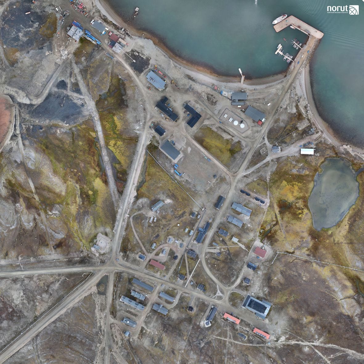
Drone images and products

OpenPolar
Global Open Access Portal for Research Data and Publications
Open Polar is a joint project between the University of Tromsø The Arctic University of Norway and the Norwegian Polar Institute. The service provides quick access to open publications and research data by providing links to full text for each record. Using different technics for automatic extraction of metadata from different sources of polar research results, Open Polar creates a collection of metadata of openly available research data and research publications. Search results can be shown as a list, as a timeline or as a map view.
To search for any term directly in Open Polar, please enter your search term, and klick on the button labelled “Search Open Polar”.
To go directly to a predefined search for “Ny-Ålesund”, please klick on the button labelled “Ny-Ålesund.
Did you find what you were looking for?