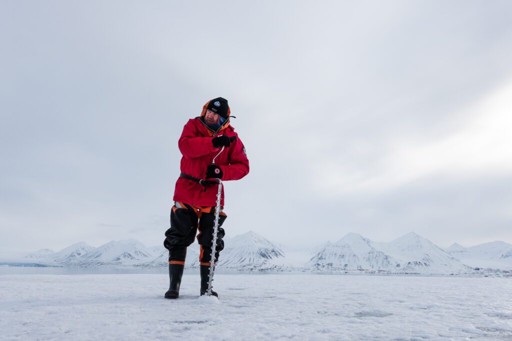
Photo: Trine Lise Sviggum Helgerud, The Norwegian Polar Institute
New Ny-Ålesund Hiking Map Reveals Seafloor Throughout Kongsfjorden
Written by Trine Lise Sviggum Helgerud, 24.06.204
original article in Norwegian
Translated by Ingrid Kjerstad, 03.07.2024
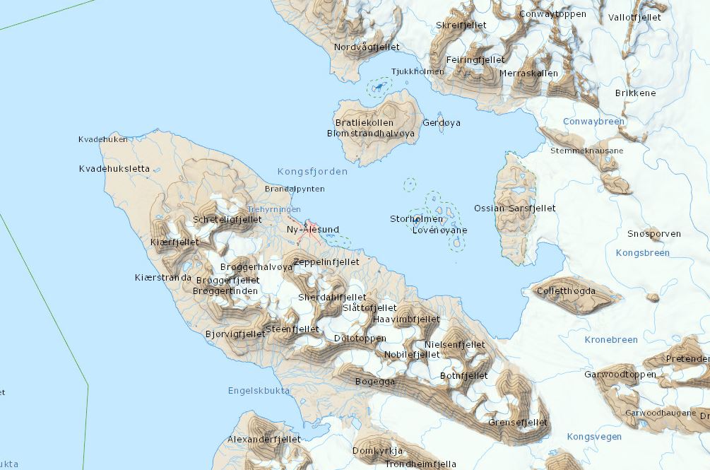
For the first time, Svalbard has areas on the map displaying the contours and formations of the seafloor. It is also the first map sheet covering the entire Kongsfjorden area in one single map.
The freshly printed hiking map directly answers a request from researchers and outdoor enthusiasts for a detailed map suitable for fieldwork and leisure activities.
Entire Kongsfjorden on a Single Map
The Norwegian Polar Institute is responsible for topographic mapping in Svalbard, serving as the main producer of topographic and geological maps in the Norwegian polar regions.
Approximately 40 individuals reside and work in the world’s northernmost settlement. Aside from the group of houses forming the research community of Ny-Ålesund, there are endless hiking opportunities. High mountains, glaciers, welfare cabins, wildlife, and a bustling fjord – nature attracts many who seek this place.
– Detailed, up-to-date topographic maps are essential for safe navigation in nature, states cartographer Roger Willy Hagerup. He spearheaded the map, which took roughly seven months to complete.

The map feature covers Ny-Ålesund and the Kongsfjorden area at a scale of 1:50,000, extending from the glaciers Holtedahlfonna, Kronebreen, and Kongsvegen in the east to the mouth of Kongsfjorden in the west.
– Previously, we had to use four different map sheets at a scale of 1:100,000 to display the same areas: Map sheets A7 Kongsfjorden, A6 Krossfjorden, B6 Eidsvollfjellet, and B7 Tre Kroner. This is the first map where we see the entire fjord on a single map, says cartographer Roger Willy Hagerup.
Seafloor in Detail
Svalbard now receives its first topographic map featuring contours and formations over the entire seafloor, with selected depths. While marine charts provide detailed information on depths, soundings, and depth contours, a visual representation with shadows and depth like this has not been seen before.
The detailed seafloor fills a large area on the map that would otherwise be just blue and devoid of content. Sea ice researcher Sebastian Gerland has conducted fieldwork in Kongsfjorden for over 20 years and sees great value in the map.
– With the map and the detailed depiction of the seafloor, we can provide new researchers coming to work in Kongsfjorden with a thorough overview of the area. The new scale is much more detailed than before, and it is significantly advantageous for planning and conveying fieldwork, says Sebastian about the map.
Majestic glaciers extend into the fjord’s inner reaches of Kongsfjorden. By the glacier fronts outlined on the map, one can clearly observe on the seafloor the changes that have occurred in nature over the past decades.
– One gets an indication of the glaciers’ former grandeur by seeing how far the glaciers extended on the seafloor before retreating, says Hagerup.

New Names and Information
Cartographer Hagerup collaborated with colleague Anders Skoglund, who shaded the seabed. Skoglund also crafted the award-winning map ‘Kongsfjorden in 3D’, featured on the backside of the hiking map. Additionally, archaeologist Per Kyrre Reymert, Kings Bay’s cultural heritage advisor Ingrid Rekkavik, and bird researcher Geir Wing Gabrielsen contributed with details on buildings, abandoned mines, historical infrastructure, bird colonies, cabins, and local names.
New and updated place names and cabins are often used as landmarks for researchers working in the fjord.
– It is very helpful that they are now drawn in. It facilitates communication during fieldwork and enhances safety when orienting in an emergency, says Gerland.
Link: All Norwegian place names in the Arctic and Antarctic are gathered in an open database. Along with many of the names, information on history and origins of the name is provided.
Maps on Svalbard
The Norwegian Polar Institute is Norway’s main producer of topographical and geological maps in Norwegian polar regions and is responsible for the topographic mapping of Svalbard, Jan Mayen in the north and Bouvetøya and the Norwegian dependent territories in the Antarctic. They publish both digital and printed maps.
Did you find what you were looking for?