Illustration by Derek McKay, NORCE.
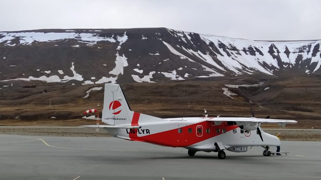
SIOS airborne remote sensing mission with the Dornier in the Ny-Ålesund area 2021
By Shridhar Jawak (SIOS), Agnar H. Sivertsen (NORCE) and Christiane Hübner (SIOS)
During this early fall, you may observe the Dornier passenger aircraft operated by Lufttransport fly some unusual patterns above the glaciers close to Ny-Ålesund. These flights are part of the SIOS airborne remote sensing mission conducted by the SIOS member institution NORCE. In total, 11 projects received funding through the call for opportunity in 2021, whereof three will be conducted in the Ny-Ålesund area.
During the flights, hyperspectral sensors and cameras onboard the aircraft will take aerial images from areas relevant for the research projects.
The hyperspectral sensors capture imagery in hundreds of spectral bands of the visible spectrum. Such hyperspectral data can be used to map things like minerals, vegetation, and animal distribution. Aerial images are important tools for mapping sea ice or glaciers, counting seals, and generating 3D models of the terrain. The cameras onboard the aircraft can give imageries of about 10 cm resolution. A big advantage is that they can be captured even during cloudy days, as opposed to satellite images that are dependent on cloud free conditions.
The three projects in the Ny-Ålesund area for 2021 are:
- The project KoHoDEM led by Jack Kohler from Norwegian Polar Institute will construct a high accuracy digital elevation model (DEM) of Kongsvegen using aerial images and compare it with previous DEMs. This project is also important to ensure glacier safety by mapping detailed crevasses to avoid accidents like the one that happened during last spring in Holtedahlfonna.
- The project CryoSort led by Livia Piermattei and Andreas Kääb from University of Oslo will focus on studying sorted periglacial circles. Svalbard hosts one of the best examples of sorted soil circles on Earth, located at the westernmost tip of the Brøgger peninsula. The overall objective is to better understand the evolution in space and time of the sorted soil circles by using aerial images and hyperspectral data.
- The project SVALMELTPLUME led by Guy Tallentire from Loughborough University aims to quantify the volumes of meltwater discharge and sediment from both a terrestrial glacier-fed river system and marine-terminating glacier system, using field and earth observation approaches. The project has two sites in Ny-Ålesund: Bayelva river plume and Blomstrandbreen subglacial plume. In addition to collecting the in-situ samples, this group will make use of aerial images and hyperspectral data collect by Dornier for calibration and validation of both in-situ measurements and satellite data.

The equipment was installed onboard the aircraft in 2018 and is funded by the Research Council of Norway through the SIOS-InfraNor infrastructure project. Read more about the SIOS airborne remote sensing missions and NORCE Dornier project.
For more information, contact SIOS Remote Sensing Officer: Shridhar Jawak and/or NORCE Senior Research Scientist: Agnar H. Sivertsen.
Did you find what you were looking for?